Purchase and Download The Flathead Lake Vacation Guide here.
Enjoy an virtual drive around MONTANA’S FLATHEAD LAKE.
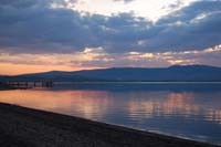
Flathead Lake Montana is considered the largest freshwater lake west of the Mississippi within the boundaries of the continental United States. The Lake contains cover 200 square miles of water and 185 miles of shoreline. Studies at the Flathead Biological Station show that water quality in Flathead Lake is among the best in the world. Its major tributaries are the Flathead and Swan Rivers. Numerous small streams flow directly into the lake at its shoreline, particularly on the wetter East Shore. Kerr Dam is located at the outlet of Flathead Lake in Polson. Regulations of outflow by KERR Dam maintain the lake level between 2,883 and 2,893 feet above sea level.
The southern half of Flathead Lake lies within the boundary of the Confederated Salish and Kootenai Tribes Flathead Reservation created in 1855 by the Hellgate Treaty. The unique relationship between the United States and the Flathead Nation insists that all non-tribal member folks must purchase a tribal recreation permit
Recreation on Flathead Lake
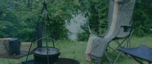
Recreational activities on and around Flathead Lake include multiple camping sites, including the 13 public access site maintained by Montana Fish Wildlife and Parks, sailing in and around the Dayton area, motor boating, waterskiing, swimming, fishing, and picnicking.
Fishing access sites include: Bigfork, Elmo, Juniper Beach, and Sportsman’s Bridge.
State Parks:
State Parks include: Big Arm, Finley Point, Wayfarers, West Shore State Park, Woods Bay, Yellow Bay, and Wild Horse Island.
One of the largest islands within Flathead Lake is Wild Horse Island State Park which is 2,165 acres. There is no over-night camping on Wild Horse and the park is only accessible by boat.
All sites maintained by Montana Fish Wildlife and Parks have boat launches, camping, and swimming facilities, as well as toilets.
There are three highways around the 185 miles of shoreline of Flathead Lake. Those three highways are US Highway 93 along the West Shore of Flathead Lake, Montana Highway 82 along the north of The Lake and Montana Highway 35 along the East Shore of The Lake.
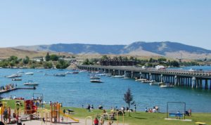
The Lake’s most southern point where US Highway 93 and Montana Highway 35 intersect is Polson Montana.
Communities on Flathead Lake
 Polson is a small town of about 7000 people that was incorporated in 1910. It is located on the The Flathead Indian Reservation is governed by The Confederated Salish Kootenai Tribe which is headquartered five miles to the south of Polson in Pablo. Polson is a lake shore community in the trading center for one of most fertile farming areas in Montana. This prime cherry growing region is home to dozens of orchards, which Polson celebrates with an annual Cherry Festival. The Friday Farmers Market is about a block long and is a local and tourist attraction. The Mission Mountain Range is to the east of Polson with its snowcapped peaks. The Flathead River that flows along the west side of Polson features whitewater rafting and Kerr Dam.
Enjoy Polson Montana
Two museums are located in Polson, The Miracle of America and the Polson-Flathead Historical Museum , both members of the Mission Valley Museums consortium. Five miles to the south in Pablo, the governmental headquarters of the Flathead Nation is the Peoples Center, a museum focused on the preservation of the rich history of the Tribes. All offer many displays and historic memorabilia. We would encourage you to visit any one of Museums located around Flathead Lake.
Several city parks dot the Polson landscape along the lake, and hosts a 27-hole golf course . In the summertime, when temperatures range from 80 to 95 degrees Polson plays host to many festivals and events including the Mission Mountain NRA Rodeo in June, the Flathead Lake Basketball Tournament in July, The Classic Car Show in August, the Mack Days Fishing Event in September as well as numerous concerts and other events through the summer season.
Moving there is a fishing access point on the north side of the highway. The Ducharme fishing access site is about 3 miles east on Montana Highway 35. It is an undeveloped 51 acre public access point with a small boat launch which resides within the boundaries of the Flathead Nation, therefore Tribal permits are required.
East Shore of Flathead Lake
Finley Point State Park is about 11 miles from Polson on Montana Highway 35. Turn left at the old Finley Point store and travel about 4 miles to reach the park. Finley Point State Park offers 18 campsites; 2 tent only, with fire rings and grills, firewood, bear resistant storage locker, boat trailer parking, extra vehicle parking, picnic tables, hookup (electric 30, 50 amp and water), utilities, 16 boat slips up to 25 feet long, boat mooring, picnic tables, trash cans, and drinking water. Fees are charged for day use, camping and amenities.
The east shore route includes a variety of locally grown apples, plums, and cherries stands where visitors can purchase fresh fruit directly from the growers. Also along the east shore route there are many motels and rental cabins that time has forgotten. It is in these non-chain accommodations that you can experience a Flathead Lake experience that sets it apart from the refined and polished brands you have come to know.
Camping Area
The next camping opportunity is Blue Bay Campground.
Blue Bay Campground is a fee campground operated by the Confederated Salish Kootenai Tribes. The campground hosts both basic and full campsites, a fishing dock, and marina.
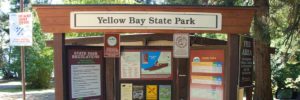
Yellow Bay State Park. is just north of Blue Bay. It is a public camping and fishing access site and is located on the Flathead Indian Reservation, so you will need a Confederated Salish and Kootenai Tribe fishing license to enjoy the excellent fishing here.
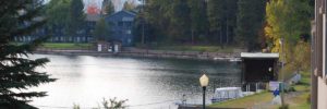
Flathead Lake, Woods Bay.
Woods Bay has a population of about 1000 people and one big corner. At the corner on the left side of the highway while traveling north you will find the Woods Bay Café. Stop by the lunch, the prices are very reasonable and the food is worth every dime. They also sell local honey which is, in my opinion some of the best around. At mile marker 27 turn west off of Montana highway 35 to reach the Woods Bay Fishing Access Site. This fishing access site hosts a boating ramp, fishing and public restrooms.
Bigfork Montana is 14 miles further on highway 35. Just as you enter Bigfork on the left side of the road is Wayfarers State Park. Wayfarers Park is a 67 acre state park that provides users with camping, restrooms and showers, trailer dump, and boat launch facilities. The campground maintains 27 with several tent sites located next to The Lake for visitors arriving by boat, and one ADA approved campsite. Next to the park is Harry Horn Day Use area. Wayfarers is open year-round with limited services and is available May through September offering full services.
Bigfork on Flathead Lake
Bigfork hosts many world class art galleries, fine dining, a 27-hole golf course, live theatre and ample unique shops. It was also chosen as “One of the 50 Great Towns of the West” as well as “One of the 100 Best Small Art Towns of the Nation.” Known as the Village by the Bay, as it is resides in a sheltered bay on Flathead Lake, where the Swan River meets Flathead Lake.
Population is growing in Bigfork at about 24% with urban refugees. In summer the population swells with visitors who have come to enjoy its art galleries, live theatre, sidewalk cafes, and restaurants. There are no shopping malls and few franchise businesses, rather unique food establishments and galleries. Bigfork is built on a western art theme, including many excellent sculpture pieces, supported by two bronze foundries in the region. Local artwork can be found in non-traditional venues through the village and the Bigfork Festival of the Arts the first weekend in August is worth the time to see. Bigfork also hosts a public fishing access point. The Bigfork Fishing Access Site on Flathead Lake is a 1 acre fishing access site open year round with a boat launch during the summer season.
Fishing Access Area
Just past Bigfork, turn left, west on Montana highway 82 to continue around Flathead Lake.
The next recreational opportunity is Sportsman’s Bridge Fishing Access Site. Sportsman’s Bridge is a 6 acre access site open year round and provides access to both the Flathead River and Flathead Lake. It provides access to fishing and boating and provides both high and low water ramps. Restrooms are also available at Sportsman’s Bridge Access Site.
Traveling west on Montana highway 82 to the US Highway 93 intersection. Turning north will take you to Kalispell, Whitefish, or Lost Trail Wildlife Refuge. Turn left, on to US highway 93 south to continue around Flathead Lake.
Shortly around the bend you will arrive at Somers Fishing Access Site. Somers is a 2 acre access site with a seasonal boat ramp and restroom facilities. Next to the fishing access site is the Far West Cruises dock. During the summer season Far West books boating trips around Flathead Lake. Somers was originally a sawmill town which peaked in 1901. A swimming beach, yacht club, and boat launch are available in and around Somers Bay.
Four miles south of Somers is Lakeside Montana.
West Shore, Flathead Lake
Lakeside is situated on the west shore, and near the north end of Flathead Lake. There are many parks in Lakeside including Ben Williams Park which is accessible from Soren Lane off Blacktail Road. Lakeside Waterfront Park day use located north of the intersection of Bierney Creek Road and US 93. Lakeside Volunteer Park is a 1.5 acre park with walking paths, restrooms, pavilions and docks. All facilities at Lakeside Volunteer Park are ADA accessible. Lakeside is also the host community for Blacktail Mountain Ski Resort and offers a trailhead to Foys to Blacktail Trail.
Five miles south of Lakeside on the east side of the road is West Shore State Park. West Shore State Park is a 129 acre state park with 31 sites, 7 are reserved for tent camping. The park offers vault toilets, grills/fire rings, firewood, picnic tables, bear resistant storage locker, trash cans, drinking water and interpretive displays. Although the shoreline is rocky the views of Flathead Lake and the Mission Mountain Range are impressive.
Driving South on US 93
Driving south on US Highway 93 the next town is Rollins, and then Dayton. As you come into Dayton access to Lake Mary Ronan State Park is on the right. Turn onto Lake Mary Ronan Highway and travel approximately seven miles. Lake Mary Ronan state park is 120 acres and the campground offers 27 campsites, including electricity, paved roads and a boating ramp.
Enjoy A Glass of Wine
The Mission Mountain Winery is in operation in Dayton. If you are a wine drinker you may want to grab a bottle or two.
Dayton Montana is a good point to launch to Wild Horse Island State Park. Wild Horse Island is a primitive 2,200 acre state park seven miles from the shore and is home to much wildlife including osprey, bald eagles, deer, big horn sheep, and wild horses. The consistent winds of Dayton Bay make it perfect for sailing. Dayton Yacht Harbor provides summer slips, sailboat sales and rentals, workshops, and winter dry storage. Also residing in Dayton is Mission Mountain Winery which produces approximately 6,500 cases of wine a year, and provides a tasting room.
South of Dayton is Elmo Montana. Elmo is the site of the Standing Arrow Pow Wow during the third weekend of July. This Pow Wow features dancing, drumming, and traditional Native American dress.
The South side of Flathead lake
For instance, driving south on US Highway 93 up and around the bend is Big Arm. Coming down the hill into Big Arm is Big Arm State Park. Big Arm State Park is a 217 acre state park providing camping, hiking trails, boat launch, restrooms with showers. It offers camping opportunities from May through September and limited services camping available through mid-November. Confederated Salish & Kootenai Tribal fishing license is required for fishing at this state park.
Leaving Big Arm traveling south on US Highway 93 on the left side of the road is Walstad Fishing Access Site. Walstad is a year round 2 acre fishing access site with a boat ramp, floating dock, and restroom facilities.
In conclusion, passing Walstad and traveling an additional 10 miles will return you to Polson Montana.
Flathead Lake Vacation Guide
The Ultimate Flathead Lake Vacation Guide Booklet contains every public access point around The Lake. In addition it also contains most every private campground as well. So if you are looking for public or private campgrounds around our Lake, this vacation guide has the information you will need to plan your Montana vacation. See what is included, and Read the guides Table of Contents.
How to Purchase
At $6.99 the Flathead Lake Vacation Guide downloadable booklet costs less then a Subway® sandwich you can buy in Bigfork or Polson. Insuring you have the information you need to have a Great Montana Lake Vacation.

For easy download, the vacation guide is available in formats for your tablet or smart phone. So spend less time wondering what to do and more time doing it!
Purchase your guide using our Pay-Pal option knowing your information is safe and secure and we will see you on the Lake!